Cursorius cursor
 Vulnerable
 Contributed:
| Habitats | Desert Plains, Inland Sand Dunes |
|---|---|
| Presence In Israel | Summer |
| Breeding In Israel | Breeder |
| Migration Types | Short Range / Partial |
| Zoographical Zones | Saharo-Arabian, Irano-Turanian |
| Landscape Types | Plains & Valleys, Wide Wadis, Sand Dunes |
| Vegetation Types | Steppe, Herbaceous |
| Vegetation Densities | Low |
| Nest Locations | Ground |
| Diet Types | Invertebrate |
| Foraging Grounds | Ground |
| Body Sizes | Small (up to 500g) |
| Threat Factors | Overgrazing, Habitat loss and fragmentation, Direct disturbance from human activity, Tree planting |
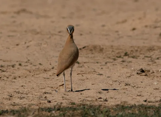
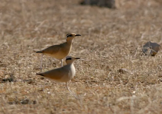
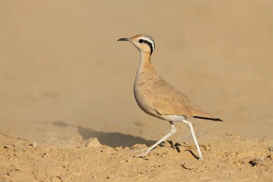
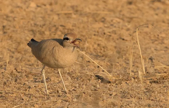
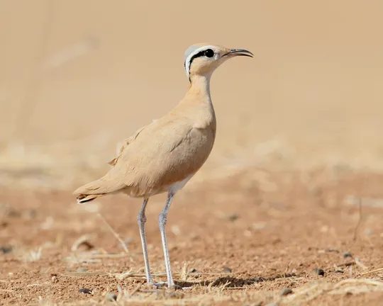
The Cream-coloured Courser is a slim, long-legged Charadriform that inhabits arid habitats. When standing it is uniformly sandy colored, with a thin black eye-stripe, a bright white eyebrow and a bluish cap. The three stripes merge on the bird’s nape forming a downward-pointing triangle. Legs are silvery-white, its bill black, slender and a bit curved. Its posture is very erect, sometimes even bent backwards. When in flight its black underwing contrasts with its white belly. Wingbeats resemble those of doves, interspersed with short glides and longer glides as it lands.
The Cream-coloured Courser summers and breeds in the Negev, particularly in its western section (the Nitsana-Shivta area and the Western Negev sands), but also in the Eastern Negev and the Northern Arava, the Meishar and the Large Wadis. A few individuals also breed in the Jordan Valley, Eastern Galilee and Southern Golan Heights. A small portion of the breeding population overwinters in these areas as well. Until the 1980s, Cream-coloured Coursers also nested in the Judean Lowlands, the Jordan Valley, eastern Samaria and the Judean Desert plateau. It is now very rare in these areas and does not breed every year.
Cream-coloured Coursers inhabit broad wadi beds, and sandy, loess and rocky plains in the desert, and dry or sparsely vegetated fields in the steppe region.
No specific conservation measures have been taken for this species to date.
- Key breeding areas should be preserved, particularly in the Northern Negev.
Nature reserves and relevant protected areas (e.g. the Loess Park) should be managed specifically for ground-nesters, including dealing with invasive and eruptive species.
Grazing should be restricted during the breeding season in the main distribution areas of the species in the Northern Negev.
Afforestation in the Northern Negev loess plains should be stopped, and areas that were already planted should be rehabilitated.
- פז, ע. 1986. עופות. מתוך אלון, ע. (עורך), החי והצומח של ארץ ישראל. כרך 6. הוצאת משרד הביטחון, ישראל.
- פרלמן, י., אלתרמן, ש. וגרניט, ב. 2011. סקר עופות דוגרים בנחלים הפנימיים, אביב 2011. דו"ח מרכז הצפרות של החברה להגנת הטבע.
- פרלמן, י., שוחט, א. ולבינגר, ז. 2009. סקר אטלס ציפורים בערבה סיכום שנת 2009. דו"ח מרכז הצפרות של החברה להגנת הטבע.
- Perlman, Y., Shochat, E. and Labinger, Z. 2011. Developing Managment plan for important bird areas in southern Israel. second annual report, Nizzana region and Arava Valley.Israeli Ornithological center, SPNI.
- Shirihai, H., 1996. The Birds of Israel. Academic Press, London.
- Symes, A. 2013. Species generation lengths. Unpublished, BirdLife International.
- Species page at Birdlife International
Contributed:
Current Occupancy Map
| Data Missing | Sporadic | Limited Sites | Low Density | High Density |
|---|---|---|---|---|
| 0 | 0 | 0 | 0 | 0 |
Distribution maps
The maps presented here provide visual information on the distribution of species in Israel from the past and present, and the changes in occupancy and breeding density during the comparison period. For further reading
Relative Abundance 2010-2020
Breeding density values in the current decade as determined from experts' opinion and observations from databases.
| Data Missing | Sporadic | Limited Sites | Low Density | High Density |
|---|---|---|---|---|
| 8 | 12 | 12 | 21 | 19 |
Relative Abundance 1980-1990
Density values based primarily on the book The Birds of Israel (Shirihai 1996).
| Data Missing | Sporadic | Limited Sites | Low Density | High Density |
|---|---|---|---|---|
| 5 | 14 | 14 | 17 | 22 |
Occupancy 1990-2020
The map shows differences in the species breeding distribution between the 1980's breeding map and the current weighted breeding evaluation. Negative value - species previously bred in the grid and is not presently breeding; positive value - species has not previously bred in the grid and is currently breeding.
| Data Missing | No Change | Occupancy Increase | Occupancy Decrease |
|---|---|---|---|
| 6 | 35 | 1 | 9 |
Change in Relative Abundance 1990-2020
The map shows the changes in the relative abundance of a species in each of the distribution grids between the breeding map of the 1980s and the weighted current breeding evaluation. Negative values - decline in abundance; positive values - increase in abundance; zero - no change in abundance.
| 80 to 100 | 50 | 20 to 30 | No Change | 30- to 20- | 50- | 100- to 80- | Data Missing |
|---|---|---|---|---|---|---|---|
| 0 | 4 | 2 | 22 | 12 | 14 | 11 | 16 |
| Rarity | |
|---|---|
| Vulnerability | |
| Attractiveness | |
| Endemism | |
| Red number | |
| Peripherality | |
| IUCN category | |
| Threat Definition according to the red book |


